


Large-scale 3-dimensional information on precipitation and wind
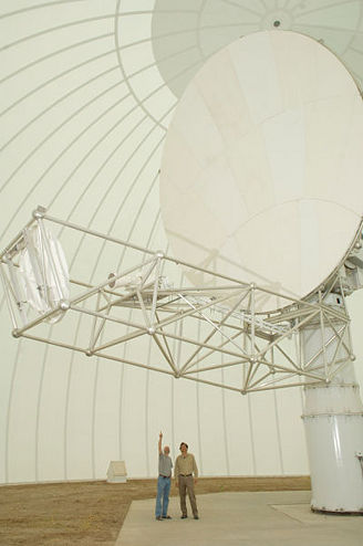 | CSU-CHILL radar is a dual-polarization S-band weather radar that is located in Greely, CO and operated by the University of Colorado State University (CSU). <<Link to the CSU-CHILL site>> |  |
 | NWS-88D radar is a S-band Doppler radar that is located in Denver, CO and operated by the National Weather Service (NWS) |  |
High-resolution 3-dimensional information on precipitation and wind
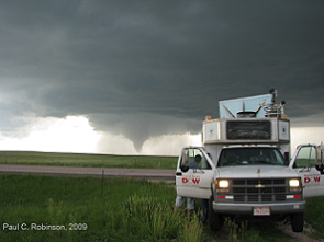 | Rapid-scan Doppler on Wheels radar is a mobile Doppler radar with a slotted waveguide array antenna that transmits 6 radar beams, each with a distinct frequency and elevation angle, nearly simultaneously. <<Link to Center for Severe Weather Research's DOW network>> |
Vertical profiles
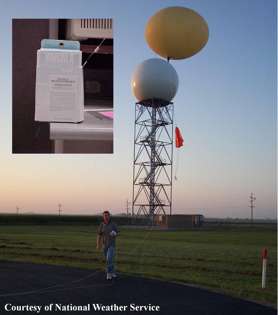 | Rawinsonde measure wind speed and direction along with pressure, altitude, geographical position, temperature, and relative humidity. It is launched at 00 UTC and 12 UTC. The closest rawinsonde to Boulder is located in Denver, CO.
|
|
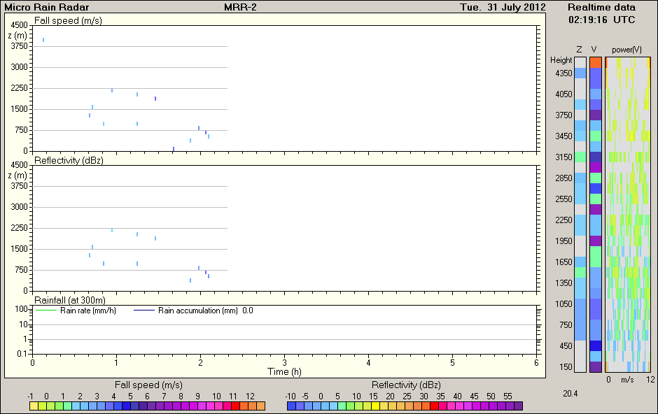
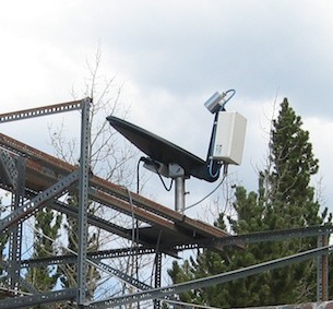 | Microwave Rain Radar (MRR) measures vertical profiles of rain fall rate, liquid water content, and drop size distribution with a high spatial (~30 m) and temporal (~10 s) resolution. MRRs are located at the CU Research Station (latest observations see below) and on the CU Campus (latest osbervations see below).
|
|
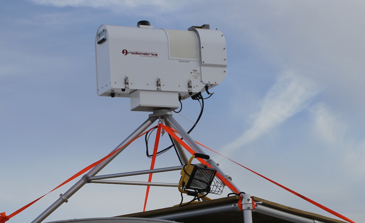 | Radiometer provides continuous humidity and temperature profiles with radiosonde-equivalent accuracy. It also provides liquid profiles. | |
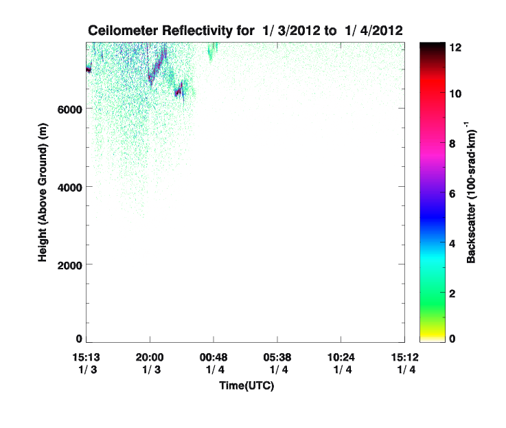
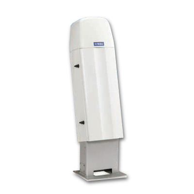 | Ceilometer provides information about the height of cloud base from the surface. This can be related to the temperature at cloud base which determines, to a large extent, the amount of infrared radiation emitted by the atmosphere. A time series of cloud height data may be used to derive cloud amount and this is important for determining both the solar and infrared components of the radiative energy budget. A ceilometer is located on the CU Campus at the Skywatch Observatory.
|
|

Surface and precipitation observations
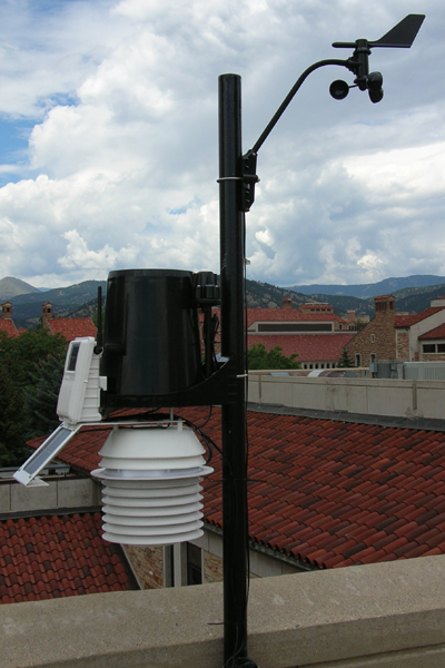 | Surface Stations are locations that measure temperature, humidity, wind speed and direction, rain accumulation, and pressure at the surface at that location. Visit the ATOC weather network | 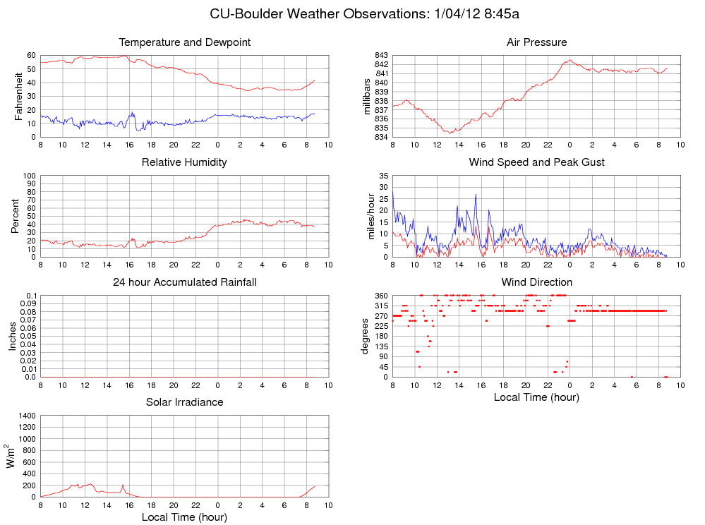 |
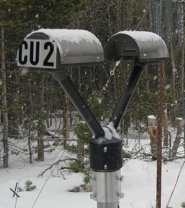
 | Raingauges record continuously and automatically precipitation intensity. | |
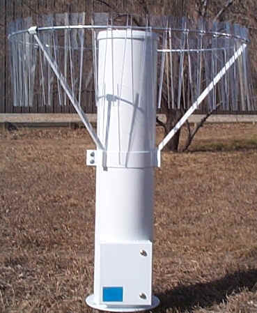
 | Laser-disdrometer measures size and velocity of each individual precipitation particle and the amount of precipitation. Disdrometer are currently installed at the Mountain Research Station at Soddie and C1, Marshall Field Site and on CU Campus. | 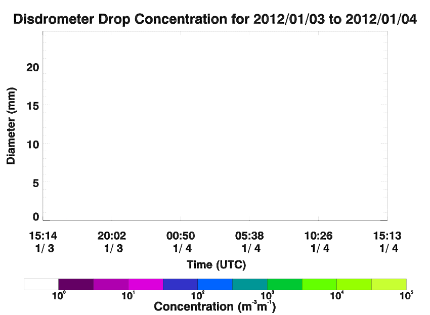 |
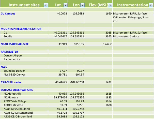
The instruments and their location are listed and shown below. More information about the instruments can be found in the main menu on top of this page.
To view current observations from CU campus and the Mountain Research Station <<click here >>.